
Mountains and great volcanoes

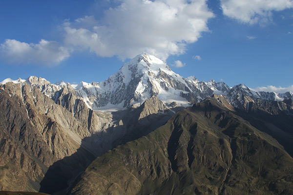
Some mountain ranges just look more impressive and majestic than others. The remote Hindu Kush is among the most spectacular ones. Here, the valleys are deep and dark with white glaciers and snow-glazed jagged peaks soaring high above. As you descend into the Wakhan Valley from the Big Pamir, you get amazing panoramic views of this massive range that forms the border with Pakistan. The Hindu Kush has 38 peaks higher than 7,000 m. The highest is Tirich Mir (7,708 m) which lies entirely inside Pakistan, however the second highest is Mt. Noshaq (7,492 m) and that one is shared by Afghanistan and Pakistan. Previously, Mt. Noshaq was off limits, but now the summit can be climbed by experienced mountaineers while the base camp can be trekked by anyone. Hindu Kush is a very dramatic mountain range, with many 6,000+ m peaks that look exactly how mountains should look like – like Mt. Baga Tangi (6,513 m) pictured.
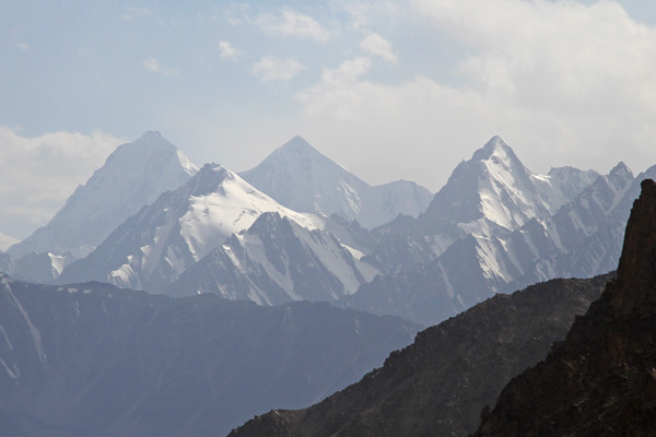
Afghanistan's highest mountain is Mt. Noshaq (7,492 m). It lies on the border to Pakistan and is also the second highest peak in the impressive Hindu Kush. Until recently, the mountain was off limits, but it is now open for climbers and trekkers. It's possible to trek to the base camp at 4,450 m from where there are spectacular views to several 7,000+ m peaks. The base camp trek is a four day trek (return) with start and end in the small settlement of Qazideh in the Wakhan Valley.
© Luke Kenyon
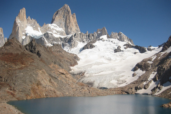
Situated way down south on the Southern Patagonian Ice Field is the village of El Chaltén popular amongst hikers, campers and adventurers as a gateway to the Los Glaciares National Park. Stopping in at the ranger’s station close to the entrance of town, visitors can obtain a photocopied map of the national park and venture out by themselves on a number of day trip and overnight hiking trails. Don’t let the photocopied map on an A4 piece of paper discourage you as the trails are well marked and most lead to the same spot at the camp close to Mt. Fitz Roy. The mountain is the tallest in the area, standing at 3,375 m which is small by South American standard’s. It does however create a challenging walk for climbers taking the windy route to the glacial pool situated at the base of the mountain.
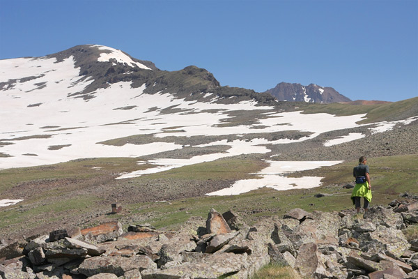
Since imposing Mt. Ararat (5,137 m) rises in the horizon behind the Turkish border, Armenia's highest mountain is the beautiful little sister Mt. Aragats (4,090 m). It is a volcano with four peaks and the beautiful green foothills are dotted with tent camps of Yezidi Kurd herders along with their livestock. An old Soviet observatory Byurakan is located at 3,200 m and is the reason why there is a road all the way up to the alpine Lake Kari that forms during spring. The southern peak can be reached by scrambling (not just trekking) while the northern peak (the highest) needs gear to be summited.
© Louise Brønden
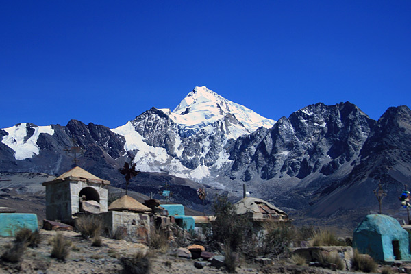
Ever dreamed of climbing a mountain? This could be your chance. Claimed to be one of the worlds easiest 6,000+ meters, Huyana Potosi rises tall right outside La Paz. In just two days you can make it to the top and back to civilization in the city. Ice axes, ropes and crampons are necessities and this is no trekking peak. Ascending to the peak is rewarding – this mountain has a real pointy peak and offers outstanding views of the altiplano, the Cordillera Real (The Royal Range) and the gleaming white peaks of the nearby Illampu mountain.
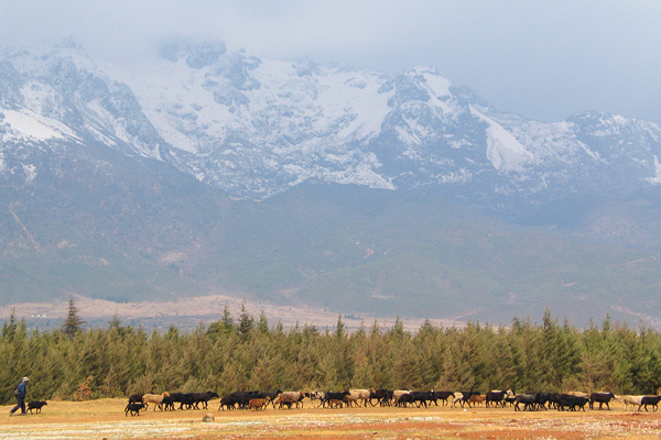
This crazily named mountain reaches 5,596 m into the sky and is capped by the southernmost glacier on the northern hemisphere. One side of Tiger Leaping Gorge is actually formed by the far side of the mountain. The snow on the peaks is eternal and can be reached in classic Chinese fashion by cable car which goes as high as 4,506 m. Here you will mingle with smoking Chinese tourists inhaling oxygen from canisters while sliding down the slope on rented toboggans. Jade Dragon Snow Mountain can be reached from Lijiang on a fun, though a bit surreal, day trip. If you are looking for a bit of serious exploration of the mountain, you can then go skiing (there are a few ropeways), hiking and even mountain climbing.
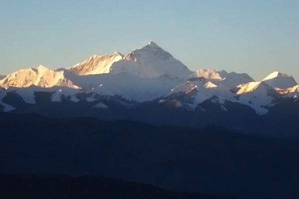
When you finally get a glimpse of the tallest peak in the world, all the hours spent winding through the Tibetan mountain ranges coupled with endless permit checks and of course altitude sickness, will immediately feel insignificant.
This is Mt Everest.
The himalaya ranges contain 14 mountains that are above 8,000 metres of which Mt. Everest is the highest, peaking at an awe-inspiring 8,848 metres above sea level. From the main lookout in the Qomolangma (Tibetan name for Mt Everest) National Park you can actually see not only Mt Everest but the entire range. It is reassuring to know that from the Tibetan side, Mt Everest appears as a perfect peak and is clearly the highest amongst its peers. Apparently, the view from the Nepalese side is slightly less impressive.
Many pilgrimages to the lookout have ended in disappointment due to the presence of clouds. Early May and early October are your best chances of clear skies.
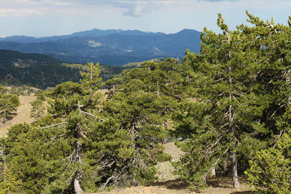
The highest mountain on Cyprus is Mount Olympus - what else could it be called. It's a pine tree covered peak, which from the distance easily blends in with other peaks in the Troodos Mountians. You can drive all the way up the ski resort (yes, they have chairlifts and runs) right below the top at 1,952 m, which is unfortunately occupied by the military. But the views over lowland Cyprus are spectacular.
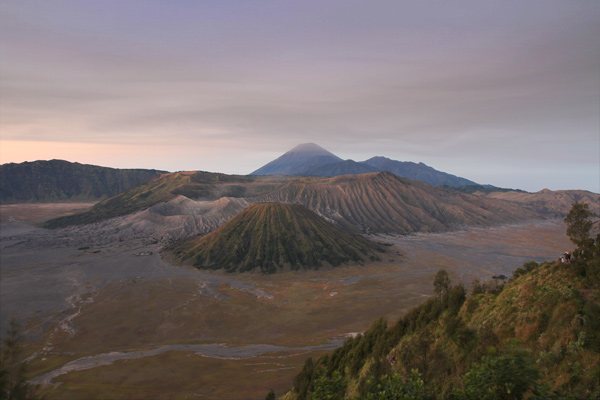
Mount Bromo, Gunung Bromo, is one of three volcanoes inside a larger caldera. Yes, volcanoes inside volcanoes. The whole Mt. Bromo experience normally involves seeing the sunrise from the viewpoint of Penanjakan overlooking the gigantic Tengger caldera (10 km across), which besides holding Mt Bromo (2,329 m), Mt Kursi (2,581 m), and Mt Batok (2,440 m) also has the Sea of Sand, a plain of volcanic ashes. From the viewpoint you descent into this lunar landscape (in jeep), for then ascent the smoking Mt Bromo on foot (or horse). You can walk on the rim and, if time, circuit the whole Mt. Bromo crater (1 h). Mt. Bromo is a major tourist attraction for both local and foreigners, so don't expect to get it to yourself. Most travellers go on an organised tour from Yogyakarta, but you can also do it yourself from Cemoro Lawang. For the true adventurer, there is a 3-4 day hike that can be done from the backside of the Bromo Tengger Semeru National Park. It is a wonderful hike and gives you a chance to see some wildlife.
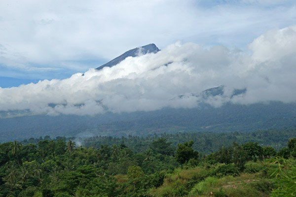
The summit of volcano Rinjani, Gunung Rinjani, (3,726 m) is not only the highest point on Lombok, but the second highest volcano in Indonesia (Gunung Kerinci on Sumatra is the highest). Rinjani is active, and so is the smaller and newer volcano, Baru Jari, inside its crater. Beside the new smoking mini cone, the crater also contains a holy lake called Segara Anak. Both the summit of Rinjani and the crater lake are considered sacred by the local Sasak people who climb the mountain as pilgrims, but anyone is welcome to do the trek when it is considered safe. There are several routes and the treks can be done from 3 days. You can arrange guide, equipment and porters in either Senaru, Sembalun Lawang or Sapit, though Senaru seems as the most popular starting place.