
Trekking peaks

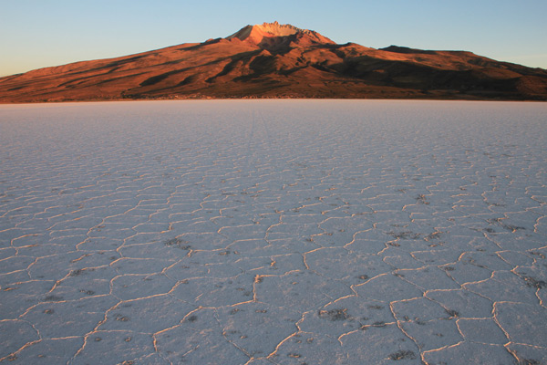
At the northern edge of the Salar de Uyuni towers the Tunupa Volcano above the salt lake. On a day trip it is possible to hike to the crater rim at about 5,000 m or even further direction the top of the mountain. The base for the hike is in the tiny village of Coquesa, where there is not much more than a few houses and a hostel. From there you can start hiking but it makes it definitely a little easier to be driven some hundreds of meters uphill close to some caves with mummies at about 4,000 m. The hike from here is quite strenuous, especially approaching the edge of the crater where the terrain is sandy with small stones. The views are amazing though and worth the effort. When you stand about 1,500 meters above the salar you quickly forget the tough climb.
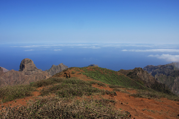
The most popular hike on São Nicolau island is probably the climb to the top of its highest mountain: Monte Gordo, just over 1,300 m high. Since recent years, the area around this mountain is protected and has become a national park. There is an information center at the start of the trail in Cachaço and they even have some leaflets with a very good trail map of the national park. The climb goes up steadily to the top from where you get 360° views of the island. With clear weather, you can see several of the Barlavento islands such as São Vicente and Santo Antão.
From here you can backtrack all the way or you can choose to just hike down a little the same way, then hike around the mountain, go over some ridges and then finally hike down to finish in the town of Praia Branca, which is strangely not a beach town as you would think of its name (praia is Portuguese for beach).
From here you can backtrack all the way or you can choose to just hike down a little the same way, then hike around the mountain, go over some ridges and then finally hike down to finish in the town of Praia Branca, which is strangely not a beach town as you would think of its name (praia is Portuguese for beach).
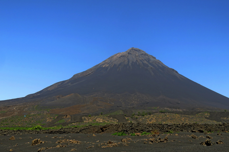
Pico do Fogo (2928 m) is Cabo Verde's highest point and, essentially, a volcano inside a volcano. It's surrounded by a black, moonscape; that will take any first-time visitor by surprise. Perfectly cone-formed the volcano itself is possible to climb in about three hours, though it's advisable to take a guide as the ascent is steep and the best paths change sporadically. Returning down, however, will take about forty minutes as the descent is made by a sprint in a cloud of dust and ash, down through the loose volcanic gravel that covers much of the volcano. A magnificent and fearsome, the volcano last erupted in 2014, and the local community here is yet to recover. This will inevitably put a limit on any visitor’s enjoyment climbing the volcano. But don't let that put you off, the money generated by homestays, the vineyards that survived and the guided climbs goes a long way in the rebuilding of the community.
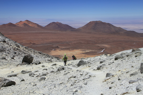
If you want to climb a volcano, you wanna get high with not too much effort and if you are acclimatised, Cerro Toco is an easy climb where you can reach 5,640 metres in less than 2 hours. It can also be a preparation for other but tougher high altitude climbs in the area.
The mountain is close to the Bolivian and Argentinean border and just about 50 kilometres away from San Pedro de Atacama. There is a road leading up a long way on the mountain from where it is just 350 altitude metres more to reach the top. The volcano does not have a conical shape such as some of its neighbours but from the summit you get an amazing view over Laguna Blanca in Bolivia and of the Licancabur volcano on the border.
The mountain is close to the Bolivian and Argentinean border and just about 50 kilometres away from San Pedro de Atacama. There is a road leading up a long way on the mountain from where it is just 350 altitude metres more to reach the top. The volcano does not have a conical shape such as some of its neighbours but from the summit you get an amazing view over Laguna Blanca in Bolivia and of the Licancabur volcano on the border.
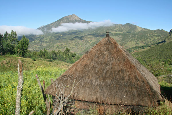
As you slowly wind your way up from Dili into the hilly backcountry, the scenery turns lush and the air cool. 11 km from Maubisse, a rocky unsealed road snakes off the potholed main road and leads to the little village of Hatubuilico at the foot of Mt. Ramelau (2,963 m). Round wooden houses with thatched roofs are now dotting the sloping fields as you keep going into valley after valley until you get clear views of Ramelau's naked peak. Trek to the top (if you have warm clothes with you) and just enjoy the views before the clouds come rolling in.
In the middle of nowhere, on the top of a Mount Sornfelli, is a defunct NATO radar station. The station is a leftover of the NATO early warning system from the Cold War. Just 20 km from Tórshavn, a road has been paved all the way to the radar station due to its former importance, securing radar communication between Europe and North America. The road has been open to the public since the station closed down, makes Sornfelli one of the most assessable peaks on the Faroe Islands, offering brilliant views of Streymoy’s rugged landscape and many the other Faroese Islands.
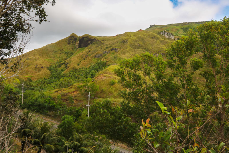
The highest point on Guam is Mt. Lamlam with its staggering height of 406 m. It's possible to hike to the peak and back in about 3-4 hours. The route can and should also include the second-highest peak, Mt. Jumullong Manglo, which is often mistaken for Mt. Lamlam from the distance, as it's covered in with crosses (it's a sacred Catholic site). A fun-fact; Mt. Lamlam actually starts at the bottom of the Mariana Trench 10,994 m below, suddenly making Mt. Lamlam the highest mountain on the planet.
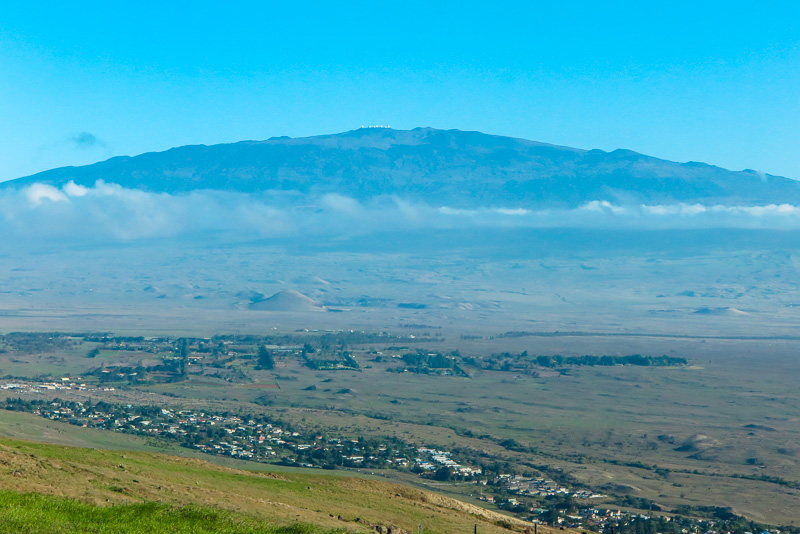
The highest volcano in Hawai'i is Mauna Kea (4207 m) and if measured from its underwater base, it's the tallest mountain in the world. The volcano is dormant and has several observatories at the summit, which can be covered in snow. If you have a true 4x4, you can drive all the way to the summit, else you have to park at the Visitor Information Station (VIS) at 2804 m. The hike to the summit will then take about 10 hours roundtrip. Since you drive from sea level to high altitude in two hours, altitude sickness is a possibility.
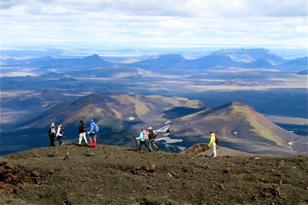
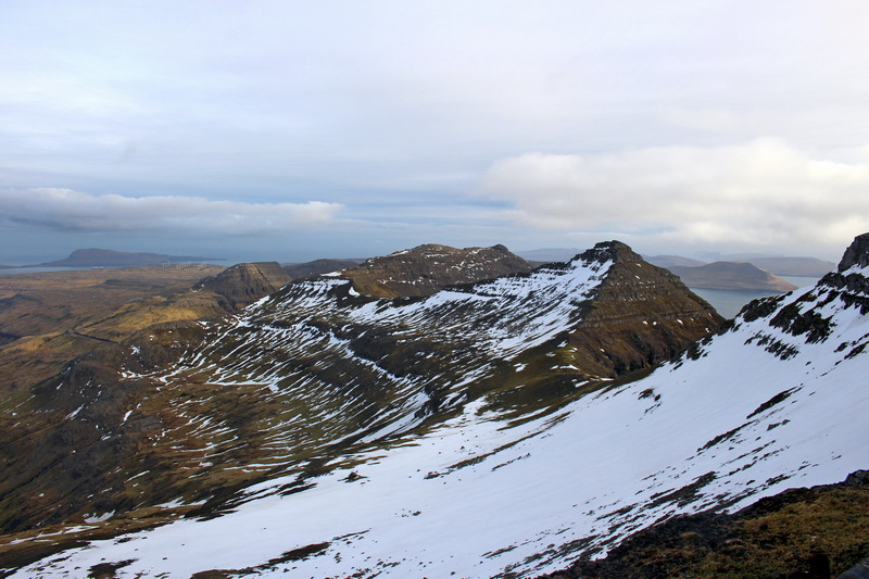
Iceland has 30 volcanoes, which are more or less active, and there are good opportunities to climb them. The volcano Hekla is active and erupts around every decade. There is about 1,490 meters to the summit and it takes about 2-3 hours each way. You trek on volcanic rock, snow, ice and very small lava gravel, which is challenging to walk on, so proper hiking boots, perhaps walking stick and warm clothing is essential. It is quite a surreal experience to sit in a volcanic crater and eat your packed lunch, and there is a fantastic view over other mountains and glaciers. The otherwise cold peak is also covered with hot steam, so if you sit down on the ground, you can warm up your bum...
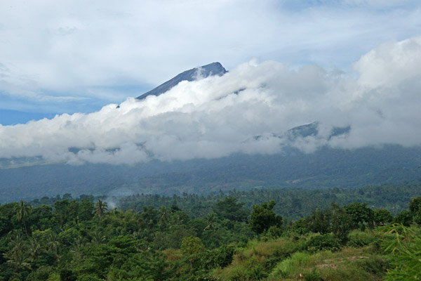
The summit of volcano Rinjani, Gunung Rinjani, (3,726 m) is not only the highest point on Lombok, but the second highest volcano in Indonesia (Gunung Kerinci on Sumatra is the highest). Rinjani is active, and so is the smaller and newer volcano, Baru Jari, inside its crater. Beside the new smoking mini cone, the crater also contains a holy lake called Segara Anak. Both the summit of Rinjani and the crater lake are considered sacred by the local Sasak people who climb the mountain as pilgrims, but anyone is welcome to do the trek when it is considered safe. There are several routes and the treks can be done from 3 days. You can arrange guide, equipment and porters in either Senaru, Sembalun Lawang or Sapit, though Senaru seems as the most popular starting place.